
What is the Purpose and Importance of Levelling?
In Surveying and Construction the Purpose and Importance of Levelling is to find the heights or elevations of different points of interest in relation to a specific known datum. Knowing that specific points of interest are at the same or different heights or elevations is fundamental to our living spaces and our working spaces.
As Human Beings, we are all very in tune with our surroundings and can feel the effects of our spaces not being level. The majority of us will feel very uncomfortable lying down on the slightest of sloping ground with our heads pointing downwards. You can experience this by going out into your garden or the local park on a nice summer’s day, and just try lying down in various places.
Disclaimer: This site, and in particular this page, contains affiliate links to products. You are under no obligation to but if you visit and buy something from their site from a link on this site, we will receive a small commission, the price you pay will remain the same. This helps to keep this website running and your help is appreciated.
Why is Levelling Important?
Levelling in surveying and construction is important because gravity is by far the most significant force affecting our everyday life. Working parallel and perpendicular to the force of gravity is fundamental in designing and constructing the homes we live in, the roads we cycle or drive on, the bridges we cross and the office blocks we work in.
We also need to be able to discount optical illusions that may make things appear either higher or lower than something else. You would not be happy to find a large puddle surrounding the front door to your house every time it rains because the surface falls towards the door, even though it looks like it is falling away.

What Does an Automatic (Dumpy) Level Measure?
A correctly adjusted/calibrated Automatic (Dumpy) Level allows the user to sight a horizontal plane from their position. This line of sight is at a right angle to the force of gravity that is felt by the person using the Automatic (Dumpy) Level, the force of gravity is also acting upon the Automatic (Dumpy) Level. For the sighting/working range (single position) of up to 50m, all measurements can be considered to be taken from this line of sight without taking into account the curvature of the Earth, in this instance we can consider the Earth to be flat!!!
What is a Dumpy Level?
A Dumpy Level is an optical surveying instrument that can be set up horizontally to enable the user to read different heights of
objects relative to the instrument. It consists of a telescope mounted on an adjustable platform called a Tribrach. The telescope can also be rotated through 360 degrees. Looking through the telescope, the user can see crosshairs that will enable the accurate reading of an E-Grad Staff.
Why is it called a Dumpy Level?
The Dumpy Level got its name from the fact that it was shorter than the Wye Level in use during the 1800’s. The Dumpy Level was made shorter by the fitting of an inverting eye-piece by Gravatt. Whilst the Dumpy Level was more compact than the Wye Level, using a Dumpy Level is not as easy as using a modern Automatic (Dumpy) Level. Reading an E-Grad Staff upside down (inverted image remember) is not easy or straightforward and it is very easy to make a reading mistake when you are busy trying to finish a levelling run.
Why do we call modern Automatic Levels Dumpy Levels?
Most people will think of the modern day Automatic Level (like the Topcon AT-B4a and the Leica NA-720) and the Dumpy Level as being the same instrument. They are in fact different instruments that perform the same task, that is, Levelling. Dumpy Levels were around before Automatic Levels and the “Dumpy Level” name has stuck in peoples vocabulary, this is why I have used (Dumpy) in the headings. Think of the term Dumpy Level in the same way we call vacuum cleaners, Hoovers. Hoover is a tradename, but it became synonymous as a vacuum cleaner and the name, or term, has stuck. All the “Dumpy Levels” produced and used in construction and surveying today are Automatic Levels.

What is the difference between an Automatic Level and a Dumpy Level?
The big difference between an Automatic Level and a Dumpy Level is the ease of use of the modern day Automatic Level.
The first major difference that is noticeable is the image of the E-Grad Staff when viewed through the telescopes. The image seen through the Dumpy level is inverted, so the engineer or surveyor will see the E-Grad Staff upside down. The image seen through the Automatic level is erect, so the engineer or surveyor will see the E-Grad Staff right way up.
The next major difference is inside the Automatic Level. All Automatic Levels have a compensator inside them. This compensator means that the Automatic Level only needs to levelled up to within the working range of the compensator. The Automatic Level now only has a circular spirit vial for levelling up the instrument. The Dumpy Level needed fine adjustment to ensure the telescope was level (horizontal). This was done by lining up to spirit vials (like the ones in a spirit level) one along the telescope and one across the telescope. To ensure the telescope was accurately level, the telescope would be rotated 180 degrees and then adjusted until the spirit vials were halfway back to the centre.
Modern day Automatic Levels are also smaller and lighter than the Dumpy Level. This is due to the automatic compensator used and now longer requiring the long spirit vials longitudinally and transversely across the telescope.
The Automatic Level can be considered to be more accurate, as it is easier to use than the Dumpy Level. This E-Grad Staff is easier to read, as the image is erect and as long as the Automatic Level is calibrated then the line of sight should always be horizontal.
What do I need to take levels with an Automatic (Dumpy) Level?
To take levels you will need the Automatic (Dumpy) Level, a tripod, an E-Grad Staff, a book to write down your readings and someone to hold the E-Grad Staff vertically, they are referred to as either a chainboy or rod man. An additional item, to aid accuracy, would be a spirit bubble vial that can be used with the E-Grad Staff. There is a standard way to carry out work with an Automatic (Dumpy) Level and I have described it here in this article about the levelling traverse.
When using an Automatic (Dumpy) Level the important factors to get accurate results is ensuring the Automatic (Dumpy) Level is correctly adjusted/calibrated, the operator is able to clearly read the E-Grad Staff and that the chainboy or rod man know how to hold the E-Grad Staff (plumb) correctly.
What is a Reduced Level?
In Surveying and Construction a Reduced Level is a calculated elevation in relation to a particular datum. The reduced level of an object or surface is usually calculated from a datum related to the height above mean sea level as observed at Newlyn, Cornwall for the whole of Great Britain. The datum in this situation is usually referred to as a Temporary Benchmark or TBM.
What is a TBM, Temporary BenchMark?
In surveying terminology, a TBM is a Temporary BenchMark. It is fixed point with known attributes of position, the most important being the height, Above Ordnance Datum (AOD). The Ordnance Datum for Great Britain was determined from a tide gauge set at Newlyn in Cornwall. The tide gauge was observed for a period of six years between 1915 and 1921, and the mean (average) sea level was calculated and set at 0.000m. A Temporary BenchMark will also have known co-ordinates in either local or Global or both, local co-ordinates will consist of Easting, Northing and Elevation and Global will consist of Latitude, Longitude and Ellipsoidal Height.
Usually Temporary Benchmarks are established from permanent Benchmarks, but since the advent of GPS Surveying these Benchmarks have not been maintained. Temporary BenchMarks are now established using GPS Surveying Equipment.
To know how to use an Automatic (Dumpy) Level, how to properly record your readings and to work out reduced levels then the following articles would be of interest.
How to carry out a levelling traverse or run.
Methods for booking a levelling run. The height of collimation method.
Methods for booking a levelling run. The Rise and Fall method.
Don’t forget that you must also check your Automatic (Dumpy) Level and accessories. The following articles would be of interest.
How to check an auto or dumpy level.
Quick and easy checks on Automatic (Dumpy) Levels.
Are you ready to buy an Automatic (Dumpy) Level? Check out the latest recommended levels and levelling kits below.

Leica NA324 Automatic Level
Built to last but at a price you can afford.
Any of the Leica NA300 series of automatic levels will serve you well. The accuracy you need and the durability you want.
24x magnification allows the easy reading of the E-Grad staff at any distance. From under 1m to over 30m from the instrument.
Stadia constant of 100 allows for easy distance calculations.
IP54 rating so the rain won't stop you from working.

Bosch GOL-20D Auto Level.
IP54 Rating for use outdoors no matter what the weather.
Self-Locking Compensator for secure transportation.
20x magnification allows the easy reading of the E-Grad staff at any distance. From 1m to over 30m from the instrument.
Long 60m Working range.
Stadia constant of 100 allows for easy distance calculations.
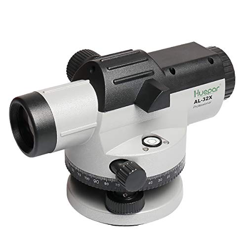
Huepar AL-32X Auto Level.
1.6mm Accuracy at 30m
32x magnification allows the easy reading of the E-Grad staff at any distance. From 1m to over 30m from the instrument.
Long Working range.
IP54 Rating for use outdoors no matter what the weather.
Stadia constant of 100 allows for easy distance calculations.
Related Articles
The Best 5 Automatic (Dumpy) Levels for under £200
The Best 5 Rotating Laser Levels for Construction